Latest IOD TRENDS:
April-May: Slightly positive-Neutral IOD

June-July:Slightly negative- Neutral IOD

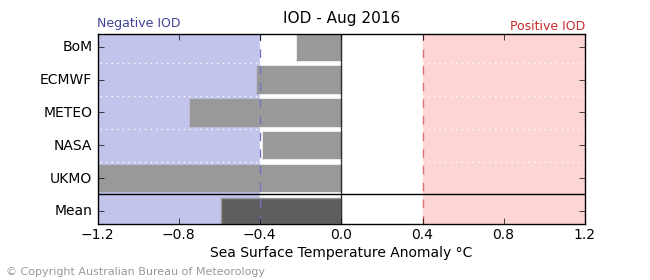
August-October: Slightly-Negative IOD
Lets see how it influences the tropical cyclone moment in May Month in indian ocean basin.....!!!..Monsoonal flow will be slightly affected by IOD. "Negative IOD favours a better South-west Monsoon".


