Weather Warning for Andhra Pradesh on 8th May 2020

Weather Forecast for Andhra Pradesh on 8th May 2020

Thundershowers possible in some areas of Srikakulam and Viziangaram districts while Hot Weather conditions will prevail in Rayalaseema

Monsoon of India

Monsoon likely by June 6th to the Kerala coasts and Pre-Monsoonal activity over interior peninsula to Increase Further

Generally Monsoon reaches the Coasts of Kerala by June-1st. Every year IMD issues a model error of (+) or (-) 4 days. All conditions became favourable during first half of May month. But the Cyclone Roanu sucked up the evolving favourable conditions and finally moved North-east wards and crossed the coast of Bangladesh.

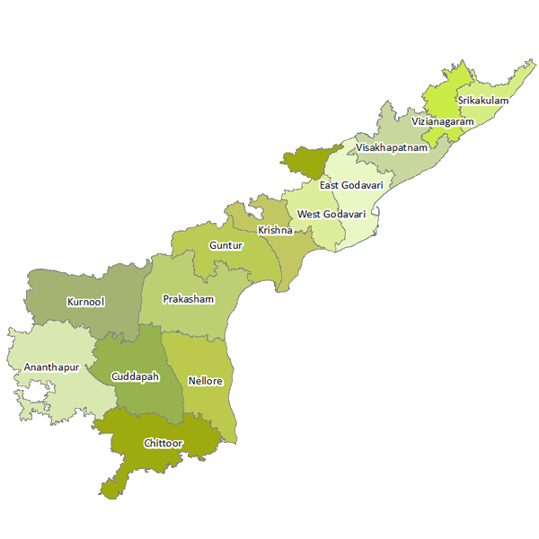
The much awaited pre-monsoon showers failed to materialize well over South Peninsular India due to Roanu. The roanu sucked up the moisture from The South india....Thus making some 5-6 dry days starting from 20th May. But some influence of Arctic Oscillation has made some Thunderstorms...which are associated with good CAPE and possess Flanking Nature...

EQUITORIAL ROSSIBY INFLUENCE AND KELVIN WAVE IMPACT ON THUNDERSTORM BUILD UP-

ROSSIBY WAVE-

KELVIN-PLOT:
INFERENCE-
The Kelvin and rossiby waves are the planetary waves which give good amounts of energy to the cyclone genisis and the building up of Thunderstorms...Here, we have used this one to estimate the rain rate in mm over some period of time...Until the monsoon onset, Some wave action will fetch some good quantum of rain to interior peninsular india with a spilled spell of rain to Coastal india....( Note that it Will be active under the presence of good amounts of Heat).

FORECAST ON ONSET AND DEVELOPMENT OF SOUTH-WEST MONSOONAL WINDS (ANIMATED)-

Observe the GIF once or Twice, we can get an idea how the Monsoon winds strengthen near Kerala coast on 7th June,2016...Once the flow strengthens, the rain starts to penetrate near the Western ghats and cause good amounts of rainfall to the west coast.... The first spell of Monsoon rain to the interiors will be around June 9th or 10th. So interiors should wait. 

Madden Julian Oscillation Forecast and its impact on Monsoon onset-

Madden Julian Oscillation (MJO) is related to the good amounts of energy suppliers across the Indian Ocean, Maritime Continent and Parts of Western Pacific Ocean. They are the most necessary thing for Increased quantum of rain or Suppressed amount of rain. 
The above Chart shows the Re-appearance of MJO in indian ocean....Favourable Monsoon Progress starts from June 7th and Touch Kerala coast on June 7th....I also assure that it will cover almost upto central Maharastra by June 12th Itself....Such a favourable conditions arising.

MJO ASSOCIATED RAINFALL ANOMALIES OVER THE COUNTRY- 

Some Meteorological Organizations like GFS, ECMWF, Ensemble members, UKMET etc conducted several experimental runs and have acquired the following details-
If we go through the Above map, We can get information about the rainfall probabilities corresponding to the MJO phase brewing over the Oceans. The magnitude of Rains depends on the strength possessed by the MJO in terms of amplitude.

WHAT ABOUT THE ENSO???

ENSO- Elnino Southern Oscillation, a key aspect of Monsoon and is daily monitored by BOM( Bureau of Meteorology), Australia. They take the the current values of ENSO and compare with the previous threshold..Finally they submit their thesis and analysis to forecasting centers of GFS, ECMWF....They will again analyze and estimate the further conclusions and give up their forecasts and display them at NOAA site....I can managed to take certain key things from them related to Monsoon.
 
The above graph tell us that the Elino is almost to dead and the Neutral conditions exists. This will further reach to a greater threshold of Lanina by July-end. The Monsoon flow amplitude is Directly proportional to the ENSO potential added that favourable conditions persist in the Indian ocean.

Climatological probable forecasts from NOAA shows a good bountiful Monsoonal rain with Normal and Above Normal rain at many parts of India....South Peninsula to get Above Normal rainfall.
JUNE-AUGUST FORECAST-
SEPTEMBER-OCTOBER FORECAST-

NOTE- These are taken with respect to initial conditions in the past...This may change time to time....Still then we can conclude a good rain to india with the transition of good amounts of tropical Monsoonal depressions so called "insitu" systems in Bay of Bengal during peak Monsoonal Months.

GFS EXPERIMENTAL RUN-


MONSOON "INSITU" SYSTEMS GENERAL CRITERIA AND ORIGINATION ??-


Monsoon systems originate due to the flow of tropical easterly jet and cross Equatorial current to the South China sea... This will create a pulse and then develop suitable conditions to make it move close to East coast of india. Generally they take place close to Mid-Central Bay of Bengal and move North. They play an important role in giving heavy rainfall during the active monsoonal phase. During break period, the Tibetian High collapses and the Monsoonal flow is affected and moves straight South-West to the foot hills of Himalyas. Western ghats Stop getting rainfall and Interior Peninsula gets some Thunderstorms. 

SEA SURFACE TEMPERATURES (LATEST)-
ENSEMBLE LAND RAINFALL SPREAD INDEX-
INFERENCE-

This index tells the Thunderstorm sustains will be good over Land and likely to peak near August and september...We can expect some flood like conditions in the interiors if India....when a active moisture supply by monsoon is expected..


BY
B.SAI PRANEETH
(WOS-TIRUPATI)

Hyderabad delight

Rain Lashes Hyderabad City...Pouring Now Over North

Place- GODAVARIKHANI, Hyderabad
Photo by- Harsha

                                                (Clouds towards North-West)


Rain lashing Northern Suburbs of City

Analysis

Thunderstorm Formation (Special Analysis)


Weather Update-01


Latest Forecast shows heavy rainfall about 500mm to western ghat areas and about 200mm to Parts of Telangana and Coastal Andhra...Some intresting rain too likely over North-interior Tamilnadu and Interior Karnataka by June-8th.


INFERENCE-

GFS experimental results revealing a possible Monsoonal Low likely over West-Central Bay of Bengal close to Odisha Coast. It will be one of the reason for the heavy monsoonal activity over South peninsula during June Month....

So with the formation of one or two Monsoonal low's, the rainfall activity over south india will be upto the mark...I can say it will be in "above Normal" with "Normal " over Tamilnadu state in short words.

Pre-Monsoon Season

SOME PICS FROM SOUTH INDIA-

PIC FROM INRINJALAKUDA (KERALA)-

"Moonu pedika beach-Parking slot"

  Photo by Sanjana Kumar

PIC FROM TIRUPATI, ANDHRA PRADESH-

"Sunset amidst high clouds-Tirupati West"

Photo by Lakshmi Prathyusha

PIC FROM AMBATTUR, CHENNAI

"Hot weather with temperature going beyond 40 degrees celcius"

Photo by Chandra Mouli

PIC FROM MUMBAI, MAHARASTRA

"Light pre-Monsoonal Showers chilling up the night and making the city colourful"

Photo from an unknown source

Rain in Andhra Pradesh

Where exactly it Rains Heavily in Andhra??

Andhra Pradesh gets Rainfall from Two Monsoons....Firstly the Summer Monsoon(June-September) and the Retreating Monsoon(October-December). During The period of Summer Monsoon, the rainfall will be associated with the Low pressure Monsoon systems forming over Mid-Central Bay of Bengal close to Odisha and North-Andhra coasts. The Monsoon low pressure systems dump flooding rains and causes floods over Krishna and Godavari systems. Sometimes, the local troughs contribute to heavy rainfall. Heavy monsoon corresponds to more and more rainfall...

Districts which receives South-West Monsoon Rainfall-

The districts like-
1)Vizianagaram 
2)Visakhapatnam
3)Srikakulam
4)Guntur
5)Krishna
6)East-Godavari 
7)West Godavari
8)Parts of Prakasham district
9)Kurnool district
10)Anathapuram district
11)Kadapa district

These above districts depend on Summer Monsoon rains and accounts to 60-80% of Annual Rainfall. While the districts like Nellore, Chittoor Districts gets very less Summer Monsoonal rainfall (less than 40% of annual rainfall).
During Summer Monsoon, the heavy rainfall is confined to North coastal districts of Andhra and the South Andhra districts gets less rainfall. Anathapur, Kadapa, Kurnool, Western parts of Chittoor district gets less rainfall.

"North-East Monsoon Role in Making up Rainfall"-

During the Months of October and November, the Monsoon retreats fast and the cyclonic systems develop over South parts of Bay of Bengal. They generally move in North-West Directions and Affect North Tamilnadu-South Andhra Coast. Places like Tirupati, Nellore, Srikalahasthi, Kavali gets heavy to Very heavy rainfall. Some times floods are often over these places during this time. The places like Tirumala gets Extremely heavy rainfall due to Orographic lifting of clouds.
The above Picture Tells a very active North-east Trade wind flow over South Andhra and Tamilnadu coast, resulting in a heavy rainfall.

So which City can be crowned as Andhra's Rainfall King??-

So, to solve this riddle, I took the data of  Andhra's rainfall and tried to bring out 5 places, which stand top spots in the competition. The places are-
1)Tirumala
2)Araku
3)Srikalahasthi
4)Tirupati
5)Amalapuram
-- Out of these places, the places like Araku and Amalapuram gets heavy rainfall during Summer Monsoon and the remaining places Tirumala, Tirupati, Srikalahasthi gets heavy rainfall due to Cyclonic systems crossing Bay of Bengal. The places of Coastal will get unless the Bands organize well over the system. Where as, the places provided with Hill-lock systems gets torrential pounding by blocking and raising the clouds. So we can rule out the places like Tirupathi, Srikalahasthi, Amalapuram.

Taking Tirumala and Araku into consideration, we reach a tie breaker....Tirumala average tends to 1477.5mm and araku gets 1098.7mm...But when compared to Tirumala Annual rainfall, the araku rainfall is less. But araku consistently reaching its average inspite of Floods/Drought prevailing over the region of Visakhapatnam district. Hence, i prefer Araku and the surrounding areas are the places in Andhra, where the Heaviest rainfall is concentrated. Whatever it may be, cyclonic or Convectional, rainfall will hit these places, which is not the case in Tirumala. But the place of Tirumala gets extremely heavy rainfall (greater than 25cms) if any Cyclone hits the coast of South-Andhra pradesh.

BY
B.SAI PRANEETH
(WOS)

Tropical update-Last

SEVERE CYCLONE TO CROSS THE COAST NEAR COX'S BAZAAR

"MONSOON TO TOUCH KERALA COAST BY JUNE-3rd"

CYCLONE ROANU-
Cyclone Roanu is at 120kms away from gopalpur coast and is likely to intensify further. At present the peak wind reached 92.6kmphr and gusts upto 120.5kmphr. Its likely to recurve completely and approach the coast of Bangladesh close to Cox's Bazaar. Places along the coast of Odisha, West Bengal, Dhaka, Burma likely to get rain. At the same time damage is likely to be moderate over Bangladesh coast, Since the system will slightly tend to weaken near the coast. At the same time the cyclone will pull away the moisture over Andhra and Tamilnadu....letting the intense heat over Gujarath and Maharastra to dip south. There will be a drastic increase in heat over Andhra by 23rd. Many places over Andhra, North-interior Karnataka and Telangana will get 44-46 degrees back. 
FORECASTED RAINFALL-


MONSOON ONSET AND PROGRESS??

The much awaiting South-West Monsoon likely to make its progress soon after the landfall of "Cyclone Roanu". Rains will start in Kerala by June 3rd and take a sharp progress thereafter. Cyclones in bay of Bengal make Monsoon onset late, by making the Bay of Bengal Branch Much stronger. According to GFS, the monsoon is likely to touch Kerala shores by june 2nd.

LATEST MONSOON STATUS-
IMD(Indian Meterological Department) issued a heavy rainfall warning to Nicobar islands on the event of Monsoon onsetting. Heavy rain likely to continue over Nicobar islands for next 3 days..then it will shift to Andaman islands. 

Cyclone-Roanu Performance Over Andhra Pradesh-

The cyclonic storm Roanu, which moved close to Andhra Pradesh, Triggered a heavy dumping deluge with highest touching 35cms of rainfall over Sricity and 24 cms over Tada. Advance to say, It triggered over 29cms over Amalapuram and Avanigadda got 17cms. Tirupathi, which is 76kms away from coast, got 16.1cms overall from this system. Vishakapatnam received a staggering rainfall of 22cms.

ROANU DATA-


Note-
Also, it is said that the Deep-Sea areas got a bulk rainfall ranging from 650-800mm's with coastal areas getting less than 35cms. Interior areas got negligible rainfall, with Tirupathi being an exceptional case. Madanapalle, Hyderabad, Bangalore got some Isolated Thundershowers, which resulted in a relief from burning heat. Still there is a deficit in interior areas. Pre-Monsoonal Rainfall will resume after 28th May over interiors, with a good rain showers to Bangalore. These showers are temporally being halted by Cyclone Roanu.

BY
B.SAI PRANEETH
(WOS)

Tropical update-12

"A Tropical Cyclone to Take shape in Bay of Bengal-Likely to Go close To Andhra Coast...But no Landfall expected..As of Now!!"-WOS


Rain bands chased the city of chennai and caused torrential downpour for the past 2 days...Many places like Tirupathi, Tada, Kalahasthi, Poondi, Ponneri got a heavy rainfall of about 12cms. Some places over kerala has been receiving pull effect rains and the system tracking perfectly north, breaking the ridge present over nellore. Now its at 40kt wind speed (70 kmph) and at a central pressure of 993mb moving perfectly north....if it exceeds 42kt speed, its intensification may lead to the track to run parellel to the Andhra coast and make landfall near Bangladesh coast (Cox's Bazaar). In the meanwhile, the rains likely to drench the sea waters...but land areas will not get good rainfall that too in a appreciable manner. Lets see, what if the distance reduces or not.

GFS-ECMWF-Tally-


The above two weather models expecting the system to track parallel to the indian coast and reach Burma thereby. It is also expected to get closer to the coast from Nellore on wards. Heavy rain likely over Andhra Pradesh in next 48 hours.

NORTH-EAST MONSOON SYSTEM VS SUMMER SYSTEM-


Due to the High pressure area over north of india during North-east Monsoon season, the wind field rushes into the Northern part of system and gets added up...Hence the convergence increases and it helps in making up the system strong to the north. The above example proves the same.

Expected Track and Convergence

Latest emergence-

LATEST SATELLITE IMAGERY-

EXPECTED TRACK BY JTWC (JOINT TYPHOON WARNING CENTER)-

Expected outlook...

"SYSTEM LIKELY TO DEVELOP FURTHER INTO A TROPICAL CYCLONE WITHIN NEXT 2-3 HOURS (AROUND 6PM TODAY)"

BY
B.SAI PRANEETH
WEATHER OF SOUTH INDIA
TIRUPATHI

Tropical update-11


Heavy Rain Likely Over North Tamilnadu and South Coastal Andhra today Overnight-

Expected track-
GFS FORECASTED PRECIPITATION ACCUMULATION-

Rain likely over South Andhra pradesh coast and North Tamilnadu in next 48 hours. Places likely Chennai and nellore to get heavy rainfall. Tirupati to get an intense spell tomorrow . The system likely to stall near chennai for some time and move towards Central andhra coast

Tirupati Photo

A sudden change of Weather from Clear skies to Damn Cloudy-


Around 10.45am

At 11.50 am

Really clouds are ON in a spurt....Much needed respite from burning heat....Some on and off showers might occur over Chennai and Tirupati.

Pics art MMM-ambattur

Moderate Drizzle...Chennai smiles with Joy and Relief


"Raining....its raining in chennai".....says Seshadri
At the same time Mouli of ambattur takina a fresh breathe in his house top....enjoying the first spell of rain .....Now all of sudden the skies roared.....

Photo by-Chandra Mouli (WOS member)

Isolated Moderate Rains likely over chennai and surrounding areas from now...while rest of coastal Tamilnadu likely to get heavy showers

#Weather of south India

Tropical Update-10

Heavy to Very Heavy Rains Likely over South Tamilnadu and Adjoining Kaveri Delta- (Mysterious Depression 91B)

The Tropical depression INVEST-91B is about to enter the Gulf of Mannar and likely to concentrate into deep depression and cross the coast of Tamilnadu close to Pamban. After crossing the coast, the system likely to move northwards and about to cause heavy rain over North Tamilnadu from Tomorrow morning. Today, rainfall will be heavy to very heavy over South Tamilnadu districts. Flood warning has been issued to Kanyakumari, Tirunelveli, Tuticorin districts by Weather of South India yesterday.

LATEST CONVECTION AROUND THE DEPRESSION


CURRENT LOCATION OF DEPRESSION

PATH ASSOCIATED WITH THE TROPICAL DEPRESSION-

As said above, the depression is likely to enter Gulf of Mannar and hit the south Tamilnadu Coast and travel North-west for some time and then go straightly to North, says GFS  . Heavy to very Heavy rainfall will affect the parts of coastal Tamilnadu particularly South Tamilnadu coast. The cloud band will first start to build over South quadrant and then it will move to north quadrant and cause on and off heavy rains.

DAY-1-FORECAST-16/05/2016


DAY-2-FORECAST-17/05/2016


DAY-3-FORECAST-18/05/2016


Whether it rain or not in chennai and south coastal andhra-

The tropical depression likely to move North-west for some time and then move northwards and it will have good heat support an less shear to make up good rainbands over Tamilnadu coast. 
I am expecting chennai to get a rainfall between 10cm and 20cms. While tirupati will get some good rainfall from the system. 

Photography-from nagapattinam (rain lashing at present)

(DWR-RADAR)


RAIN LASHING NAGAPATTINAM COASTLINE

B.SAI PRANEETH
(WEATHER OF SOUTH INDIA)