Weather Warning for Andhra Pradesh on 8th May 2020

Weather Forecast for Andhra Pradesh on 8th May 2020

Thundershowers possible in some areas of Srikakulam and Viziangaram districts while Hot Weather conditions will prevail in Rayalaseema

1977 Andhra Super Cyclone

First Ever Super Cyclone-1977 AP Diviseema Cyclone
The land of Andhra is normally prone to Cyclones. One year out of 3 years, Andhra faces Cyclone Threat. Its most common part of Land fall of Intensive Cyclones, which normally blow the part of Country. While Tamil Nadu Holds a comparatively less chances for Threat from Cyclones. A study shows most intense storms track along to the coast of Machilipatnam-Kakinada when it forms near Andaman sea in November. The movement of Ridges and prevailing Sea Surface Temperatures regulate the flow of Cyclones in our basin alone. Another study from Andhra University says a perspective ratio of 5:9 holds good for Andhra when a cyclone forms in Bay of Bengal, while Tamil Nadu ranks with just 2:9.
ANDHRA CYCLONES (1965-2015)--


TAMIL NADU CYCLONES (1965-2015)-

Tamil Nadu systems Normally moves with more Westerly component while a Andhra Cyclone has relatively more Northward Movement than a TN cyclone. Normally when the steering ridge is present along Odisha or Andhra, Cyclones normally track towards Tamil Nadu. It is also observed that when steering Ridge is present along Burma or to the east of India, Cyclones normally track towards Andhra or Odisha.

Why 1977 Diviseema Cyclone is still remembered-
The First Cyclone to make a greater power in Magnitude holds first in Charts after 1999 Odisha Super Cyclone. Diviseema Cyclone holds a record of maintaining a wind speed of 250 km/hr (1-minute). This major Cyclone has tracked along the parts of Coastal Andhra and crossed the coast close to Machilipatnam. The coast is normally a bounty of Agricultural lands and moderately populated areas of Vijayawada, Guntur and Godavari districts. During the attack of Diviseema Cyclone, there were some fisherman along the estuary portion close to Bay of Bengal. It washed off their lives and battered the coast even harder.
This super Cyclone caused massive destruction to the lives of People, Cattle and also agricultural production. 

According to IMD classification, the 1977 Diviseema Cyclone holds a upper hand as Category 4 Extremely Severe Cyclone. But the weather tracking models were not so accurate and precise at the time of 1977. The Dvorak technique is used to determine the storm intensity. Normally, this cyclone may be having a 3-min sustenance of  220-230 kmph. Which is a Category 5 Super Cyclonic System.
A rare Satellite image of Diviseema Cyclone 1977-


Cyclone Track-


Some Pictures-


Diviseema Cyclone published in American News paper-

List of Cyclones Hitting Andhra-


Cyclone study

How to Track a Cyclone (For Layman)?

Cyclones Normally Occur in Three Seasons according to North Indian Ocean Climatology Study (1971-2016). Generally the Cyclone refers to a Windy Periphery with rain bands embedded in it. Let us see the Components of Cyclone in Brief.
It has major 5 Components-
1)EYE- It is the zone of Lowest Pressure. Basically well defined Cyclones have a Clear Sky in Eye Wall. The winds will be Zero at the Center. It is called the "Internal Frame of Reference". In other terms, the Moment (Angular Velocity) in the eye is zero. But relatively the Eye wall round the Eye moves very fast, thus forming a System.
2)EYE WALL- If we Moving away from Center of Cyclone, the loop of Dense Clouds (Often Cumulonimbus) surrounds the Eye of Cyclone. It contains maximum Heat potential inside it thus developing more strength in Bands and rains. In other Words it is sometimes referred as Central Dense Overcast.
A study from Dvorak revealed that-
  • Cat 1 Cyclone- 10-15% round the Eye is Eye wall 
  • Cat 2 Cyclone- 20-30% round the Eye is Eye wall
  • Cat 3 Cyclone- Nearly 50% round the Eye is Eye wall
  • Cat 4 Cyclone- Nearly 70-80% round the Eye is Eye wall
  • Cat 5 Cyclone- Nearly 90-95% Round the Eye is Eye Wall
3)ZONAL WIND FIELD-The region of wind field round the Cyclone is called Zonal Wind Field Area. The Winds are maximum at this Field. This area has the potential for greater damage and effects from the Cyclone.
4)OUTER CIRRUS- It is the outer most Convective parts. Normally, the Supply of Heat transfers from Sea Surface into the Eye wall. Then after eye wall, it will be transferred around the Cyclone. But that heat wont be able to Provide Heat through out the cyclone. Hence it will Cloudy and Silent in many occasions before the start of a Cyclone day. Things change drastically when the Cyclone nears.

Tracking the Systems-

The systems can be Tracked by:
1)Weather Models
2)CIMSS Charts

Weather Models-
Global Weather Models can be prioritized for a particular basin. For our Basin, we use the Global Model Consensus, to track an approaching System. I have listed the Various Models. We can't rule out any model opinion.  
The ECMWF is the European forecasting agency Model. It is useful for Tracking the Systems under Medium Range (36-120 hours). Quite accurate and reliable to estimate the near path of Cyclone. Next is UKMET. UKMET is the British Forecast Model used by BBC channel. It is also one of the important Model for Tracking in 36-72 hours range. The Changes in the Track can be Noticed first in UKMET. In 24 hour Precipitation and Track, we can use GFS model. Quite accurate in 24 Hours. 

Convergence/Divergence in Models-

The model Consensus vary much in Long Range. Always opt the range with in 72 hours, for precise tracking. Don't go beyond 72 hours. If we see the image below, i have shown the four tracks. If the time limit is around 24 hours, the all Models showing Similar output. Its called the "convergence of Models". Models Converge at the Nearness of the event. We should have patience and observation, while giving warnings. Beyond 72 hours, the models diverge more and we cant predict an accurate track for Landfall.


LATEST "EPS" TRACK FOR A CYCLONE-


Ensemble the event-
We have the theory of Ensemble Events to increase the probability of Occurrence. For such things, we have Models like-
1)GEFS (GFS Ensembles)
2)EPS (ECMWF Ensembles)
3)Multi Model Ensemble (IMD-RMC)
4) JTWC overview (Official)
These result in much more overview of the event. We can get a greater accuracy in this Model out put than the Induvidual Models like GFS, ECMWF.

How to Track the Zone of Active ITCZ (Point of Formation of Cyclone)?

Open the NOAA Site and type MJO status. I will now guide you how to tell the MJO movement. MJO makes the Inter-Tropical Convergence Zone active and creates a pulse to spin. It is called the Vortex. The vortex slowly gets energy and separate away from ITCZ and develops into a Low pressure. Then if conditions favour much, it will be called as a cyclone.
Latest Forecasts Shows the MJO will move into Western Pacific and after some days, it will re-emerge into Africa.

Steps to be Followed to Track the Cyclones-

  • Open Tropical Tidbits site or any other Paid models site like Weather Bell, Accu Weather Pro
  • Make the present analysis and just slide the Model data for 24 hours overview
  • Next note the developments.
  • If you still have doubt, tap to see for next 72 or 120 hours. If the Model output shows any active rainfall or flow of winds, mark that area.
  • Finally watch the same model output in your free time for about 2 days and finalize.


Tamilnadu drought 2016

Will our Water projects really help?

With the failure of both the Monsoons in Parts of the South India, the drought gained its threshold. The problems related to the drought might first start in the villages and later on spread into the city around April-May time. The shortage of Water is now the major consequence which we are going to face upon. 

Lack of Proper water storage plans adding up the disaster in the Tamilnadu as well as in the other states. The water which is crucial essential ingredient for our daily needs, is not being available in the crucial times. Last year Chennai witnessed floods and even Districts like Cuddalore, Pondicherry too got the same. Where did the water went? Can't the government or any concerned authority plan for the Flood water management?
The rains normally occur in phases. We can classify those phases into a drought phase and a Flood phase. The oscillation from these phases are controlled by weather parameters and they constitute the climatic features. During the flood, the water need to be preserved carefully, so that we can face the drought easily. But the flood water storage is not enough to store more amounts of Water inside a dam, mainly in a Monsoon affected places of South India.

(I have listed out the drought hit areas along the South India and Mentioned some reasons for its failure)
(This map is published by NOAA Government service, USA. Its stating the drought condition right along the South India. See the red and Yellow colours)

Any chance for Retreat?

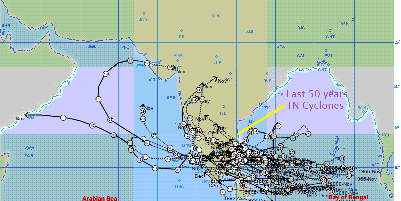
The North-east Monsoon (The only Hope for Tamilnadu) withdrawn from the indian mainland. Now we can see the dry conditions ahead for the next two Months. The cyclones are very rare to Form in February and March. Need to see the Cyclone season of April and May, since we get Cyclones along Arabian sea and Bay of Bengal. During this season, the seasonal Climatology influence the system Motion
During the time of April and May, the Cyclonic systems normally follow the climatology. The Sub-Tropical ridge position influence the systems to Move towards Burma and even towards Bangladesh-West Bengal. If lucky, the South India gets one System. For the next two to three months less possiblity of Rains.

Why its Second Largest Drought year To Tamilnadu third Largest drought to Entire India?-


I have attached some Tabulations, lets have a look-

The first Table describes the Rainfall pattern for every year in Tamilnadu. Its shows we have got 168.5mm rains this year into a historical drought second largest Drought.

The Second Table describes, the Worst drought Hit areas in South India as a whole. The Both monsoons Failed and thus bringing a Copious Water problems. Some news papers publishing a death of about 90 farmers in december Month alone. Really, the figure might go up and still up, when we head towards May Month.
Even the dam Levels along Chennai city is very poor. The dam levels according my opinion is not at all suitable to meet down the needs of the people living in the city, believing the corporation water. The Government now asking for Telugu Ganga water from Krishna River. Actually, there is a big water deficit in Andhra itself. Need to see whats the decision taken up by the state.

Some useful Tips for proper Water Management-

These tips are not taken from any internet Source, this purely from my heart- Need to see if any official sees this and ask about the steps-
1)There must be a university or an educational institution, to maintain a research continuously on Water related problems and Flood water Management.
2)The Government should seek for proper engineers to construct efficient dams and they should also see that the Material and Workers working at the plot are efficient to the given Tender amount.
3)Dams should be constructed in Some areas like Delta, Western ghats near Valparai to ensure proper water for irrigation alone.
4)Government or the authorities concerned should offer proper 0-5% rate loans to farmers, so that they can survive even in the drought conditions.
5)During flood situation, the water from the main flood stream should be diverted to an alternative Storage vessel and use it for irrigation. The plan should be implemented by seeing the proper area for citation and sourcing proper Funds to the Working staff.
6)Ground water storage pits and small tanks should be constructed in remote villages, so that we can increase the ground water Table.
7)Chembarambakkam project should be extended slightly so that the catchment area for Chennai water and for the irrigation purpose of Other villages in Tiruvallur and Kanchipuram dsitricts are ensured.
8) more plans should be built in Coastal areas from Nellore to Vedaranniyam stretch to preserve the rain water from North east Monsoon rains. This will also help, if any drought prevails over interiors.
9)In the case of Both Monsoons failure (2016), the local tanks and bore wells and even the ground water level will serve for the great purpose.
10)When ever, the villages are given importance by the government, the India can see a marginal growth in its economy and we can see more farmers, actively participating in irrigation projects.
11)Drip irrigation is an effective way to store some amounts of water for the future. A combined study shows that the 30% of water can be saved if we opt for drip type irrigation.


(Whats big happiness to the country, if we see a farmer smiling with happiness)-I pray for a green and a country with people and the government working together.

Jai Hind
Sai Praneeth, B.E student in Government College of Technology, Coimbatore.